Thousands of feet below the snowy summit of Mt. San Jacinto, a formidable feat of engineering and grit makes life as we know it in Southern California possible.
The 13-mile-long San Jacinto Tunnel was bored through the mountain in the 1930s by a crew of about 1,200 men who worked day and night for six years, blasting rock and digging with machinery. Completed in 1939, the tunnel was a cornerstone in the construction of the 242-mile Colorado River Aqueduct. It enabled the delivery of as much as 1 billion gallons of water per day.
The tunnel is usually off-limits when it is filled and coursing with a massive stream of Colorado River water. But recently, while it was shut down for annual maintenance, the Metropolitan Water District of Southern California opened the west end of the passage to give The Times and others a rare look inside.
“It’s an engineering marvel,” said John Bednarski, an assistant general manager of MWD. “It’s pretty awe-inspiring.”
The 16-foot-diameter San Jacinto Tunnel runs 13 miles through the mountain. While shut down for maintenance, the tunnel has a constant stream of water entering from the mountain.

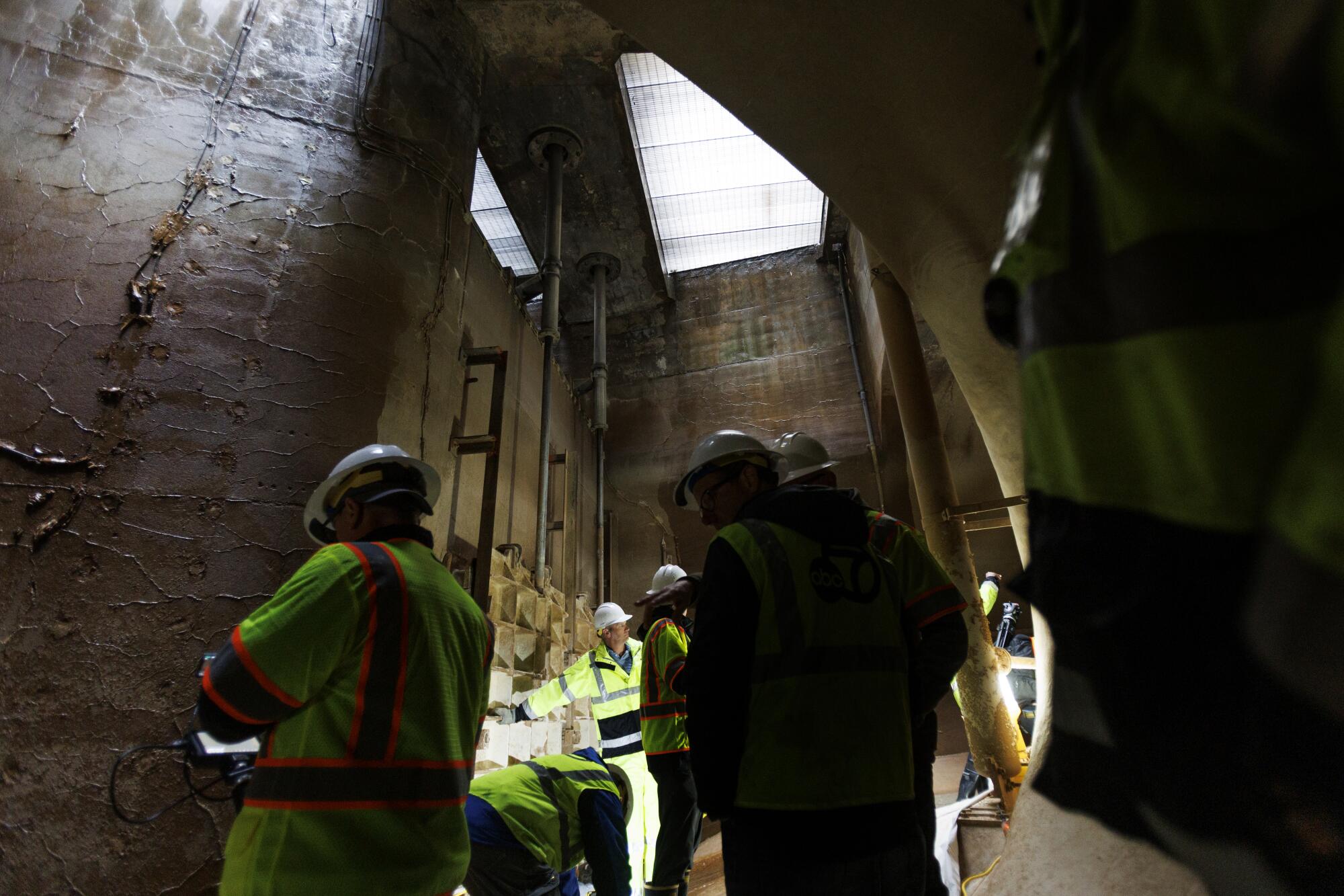
A group visits the west end of the San Jacinto Tunnel, where the mouth of the water tunnel enters a chamber.
He wore a hard hat as he led a group to the gaping, horseshoe-shaped mouth of the tunnel. The passage’s concrete arch faded in the distance to pitch black.
The tunnel wasn’t entirely empty. The sound of rushing water echoed from the walls as an ankle-deep stream flowed from the portal and cascaded into a churning pool beneath metal gates. Many in the tour group wore rubber boots as they stood on moist concrete in a chamber faintly lit by filtered sunlight, peering into the dark tunnel.
This constant flow comes as groundwater seeps and gushes from springs that run through the heart of the mountain. In places deep in the tunnel, water shoots so forcefully from the floor or the wall that workers have affectionately named these soaking obstacles “the fire hose” and “the car wash.”
Standing by the flowing stream, Bednarski called it “leakage water from the mountain itself.”
Mt. San Jacinto rises 10,834 feet above sea level, making it the second-highest peak in Southern California after 11,503-foot Mt. San Gorgonio.
As the tunnel passes beneath San Jacinto’s flank, as much as 2,500 feet of solid rock lies overhead, pierced only by two vertical ventilation shafts.

Snow covers Mt. San Jacinto, as seen from Whitewater, in March. At the base of the mountain, the 13-mile San Jacinto Tunnel starts its journey. The tunnel transports Colorado River water to Southern California’s cities.
During maintenance, workers roll through on a tractor equipped with a frame bearing metal bristles that scrape the tunnel walls, cleaning off algae and any growth of invasive mussels. Workers also inspect the tunnel by passing through on an open trailer, scanning for any cracks that require repairs.
“It’s like a Disneyland ride,” said Bryan Raymond, an MWD conveyance team manager. “You’re sitting on this trailer, and there’s a bunch of other people on it too, and you’re just cruising through looking at the walls.”
Aside from the spraying and trickling water, employee Michael Volpone said he has also heard faint creaking.
“If you sit still and listen, you can kind of hear the earth move,” he said. “It’s a little eerie.”
Standing at the mouth of the tunnel, the constant babble of cascading water dominates the senses. The air is moist but not musty. Put a hand to the clear flowing water, and it feels warm enough for a swim.
On the concrete walls are stained lines that extend into the darkness, marking where the water often reaches when the aqueduct is running full.
Many who have worked on the aqueduct say they are impressed by the system’s design and how engineers and workers built such a monumental system with the basic tools and technology available during the Great Depression.
Pipelines and tunnels
The search for a route to bring Colorado River water across the desert to Los Angeles began with the signing of a 1922 agreement that divided water among seven states. After the passage of a $2-million bond measure by Los Angeles voters in 1925, hundreds of surveyors fanned out across the largely roadless Mojave and Sonoran deserts to take measurements and study potential routes.
The surveyors traveled mostly on horseback and on foot as they mapped the rugged terrain, enduring grueling days in desert camps where the heat sometimes topped 120 degrees.
Planners studied and debated more than 100 potential paths before settling on one in 1931. The route began near Parker, Ariz., and took a curving path through desert valleys, around obstacles and, where there was no better option, through mountains.
In one official report, a manager wrote that “to bore straight through the mountains is very expensive and to pump over them is likewise costly.” He said the planners carefully weighed these factors as they decided on a solution that would deliver water at the lowest cost.
-
Share via
Those in charge of the Metropolitan Water District, which had been created in 1928 to lead the effort, were focused on delivering water to 13 participating cities, including Los Angeles, Burbank and Anaheim.
William Mulholland, Los Angeles’ chief water engineer, had led an early scouting party to map possible routes from the Colorado River to Southern California’s cities in 1923, a decade after he celebrated the completion of the 233-mile aqueduct from the Owens Valley to Los Angeles with the triumphant words, “There it is. Take it.”
The aqueduct’s design matched the audaciousness of the giant dams the federal government was starting to build along the Colorado — Hoover Dam (originally called Boulder Dam) and Parker Dam, which formed the reservoir where the aqueduct would begin its journey.
Five pumping plants would be built to lift water more than 1,600 feet along the route across the desert. Between those points, water would run by gravity through open canals, buried pipelines and 29 separate tunnels stretching 92 miles — the longest of which was a series of nine tunnels running 33.7 miles through hills bordering the Coachella Valley.
To make it possible, voters in the district’s 13 cities overwhelmingly approved a $220-million bond in 1931, the equivalent of a $4.5-billion investment today, which enabled the hiring of 35,000 workers. Crews set up camps, excavated canals and began to blast open shafts through the desert’s rocky spines to make way for water.
In 1933, workers started tearing into the San Jacinto Mountains at several locations, from the east and the west, as well as excavating shafts from above.
Black-and-white photographs and films showed miners in hard hats and soiled uniforms as they stood smoking cigarettes, climbing into open rail cars and running machinery that scooped and loaded piles of rocks.
Crews on another hulking piece of equipment, called a jumbo, used compressed-air drills to bore dozens of holes, which were packed with blasting power and detonated to pierce the rock.

A piece of equipment called a drill jumbo is used during construction of the San Jacinto Tunnel.
(Courtesy of Metropolitan Water District of Southern California)
The work progressed slowly, growing complicated when the miners struck underground streams, which sent water gushing in.
According to a 1991 history of the MWD titled “A Water Odyssey,” one flood in 1934 disabled two of three pumps that had been brought in to clear the tunnel. In another sudden flood, an engineer recalled that “the water came in with a big, mad rush and filled the shaft to the top. Miners scrambled up the 800-foot ladder to the surface, and the last man out made it with water swirling around his waist.”
Death and delays
According to the MWD’s records, 13 workers died during the tunnel’s construction, including men who were struck by falling rocks, run over by equipment or electrocuted with a wire on one of the mining trolleys that rolled on railroad tracks.
The Metropolitan Water District had originally hired Wenzel & Henoch Construction Co. to build the tunnel. But after less than two years, only about two miles of the tunnel had been excavated, and the contractor was fired by MWD general manager Frank Elwin “F.E.” Weymouth, who assigned the district’s engineers and workers to complete the project.
Construction was delayed again in 1937 when workers went on strike for six weeks. But in 1939, the last wall of rock tumbled down, uniting the east and west tunnels, and the tunnel was finished.

John Bednarski, assistant general manager of the Metropolitan Water District of Southern California, stands in a water tunnel near the end point of the larger San Jacinto Tunnel, which carries Colorado River water.
The total cost was $23.5 million. But there also were other costs. As the construction work drained water, many nearby springs used by the Native Soboba people stopped flowing. The drying of springs and creeks left the tribe’s members without water and starved their farms, which led to decades of litigation by the Soboba Band of Luiseño Indians and eventually a legal settlement in 2008 that resolved the tribe’s water rights claims.
The ‘magic touch’ of water
By the time the tunnel was completed, the Metropolitan Water District had released a 20-minute film that was shown in movie theaters and schools celebrating its conquest of the Colorado River and the desert. It called Mt. San Jacinto the “tallest and most forbidding barrier.”
In a rich baritone, the narrator declared Southern California “a new empire made possible by the magic touch of water.”
“Water required to support this growth and wealth could not be obtained from the local rainfall in this land of sunshine,” the narrator said as the camera showed newly built homes and streets filled with cars and buses. “The people therefore realized that a new and dependable water supply must be provided, and this new water supply has been found on the lofty western slopes of the Rocky Mountains, a wonderland of beauty, clad by nature in a white mantle of snow.”
Water began to flow through the aqueduct in 1939 as the pumping plants were tested. At the Julian Hinds Pumping Plant, near the aqueduct’s halfway point, water was lifted 441 feet, surging through three pipelines up a desert mountain.

March 2012 image of the 10-foot-diameter delivery lines carrying water 441 feet uphill from the Julian Hinds Pumping Plant.
(Los Angeles Times)
From there, the water flowed by gravity, moving at 3-6 mph as it traveled through pipelines, siphons and tunnels. It entered the San Jacinto Tunnel in Cabazon, passed under the mountain and emerged near the city of San Jacinto, then continued in pipelines to Lake Mathews reservoir in Riverside County.
In 1941, Colorado River water started flowing to Pasadena, Beverly Hills, Compton and other cities. Within six years, another pipeline was built to transport water from the aqueduct south to San Diego.
The influx of water fueled Southern California’s rapid growth during and after World War II.
Over decades, the dams and increased diversions also took an environmental toll, drying up much of the once-vast wetlands in Mexico’s Colorado River Delta.

John Bednarski, assistant general manager of the Metropolitan Water District, walks in a water tunnel near the end point of the larger San Jacinto Tunnel.
An impressive design
Today, 19 million people depend on water delivered by the MWD, which also imports supplies from Northern California through the aqueducts and pipelines of the State Water Project.
In recent decades, the agency has continued boring tunnels where needed to move water. A $1.2-billion, 44-mile-long conveyance system called the Inland Feeder, completed in 2009, involved boring eight miles of tunnels through the San Bernardino Mountains and another 7.9-mile tunnel under the Badlands in Riverside County.
The system enabled the district to increase its capacity and store more water during wet years in Diamond Valley Lake, Southern California’s largest reservoir, which can hold about 260 billion gallons of water.
“Sometimes tunneling is actually the most effective way to get from point A to point B,” said Deven Upadhyay, the MWD’s general manager.
Speaking hypothetically, Upadhyay said, if engineers had another shot at designing and building the aqueduct now using modern technology, it’s hard to say if they would end up choosing the same route through Mt. San Jacinto or a different route around it. But the focus on minimizing cost might yield a similar route, he said.
“Even to this day, it’s a pretty impressive design,” Upadhyay said.
When people drive past on the I-10 in Cabazon, few realize that a key piece of infrastructure lies hidden where the desert meets the base of the mountain. At the tunnel’s exit point near San Jacinto, the only visible signs of the infrastructure are several concrete structures resembling bunkers.
When the aqueduct is running, those who enter the facility will hear the rumble of rushing water.
The tunnel’s west end was opened to a group of visitors in March, when the district’s managers held an event to name the tunnel in honor of Randy Record, who served on the MWD board for two decades and was chair from 2014 to 2018.
Speaking to an audience, Upadhyay reflected on the struggles the region now faces as the Colorado River is sapped by drought and global warming, and he drew a parallel to the challenges the tunnel’s builders overcame in the 1930s.
“They found a path,” Upadhyay said. “This incredible engineering feat. And it required strength, courage and really an innovative spirit.”
“When we now think about the challenges that we face today, dealing with wild swings in climate and the potential reductions that we might face, sharing dwindling supplies on our river systems with the growing Southwest, it’s going to require the same thing — strength, courage and a spirit of innovation,” he said.

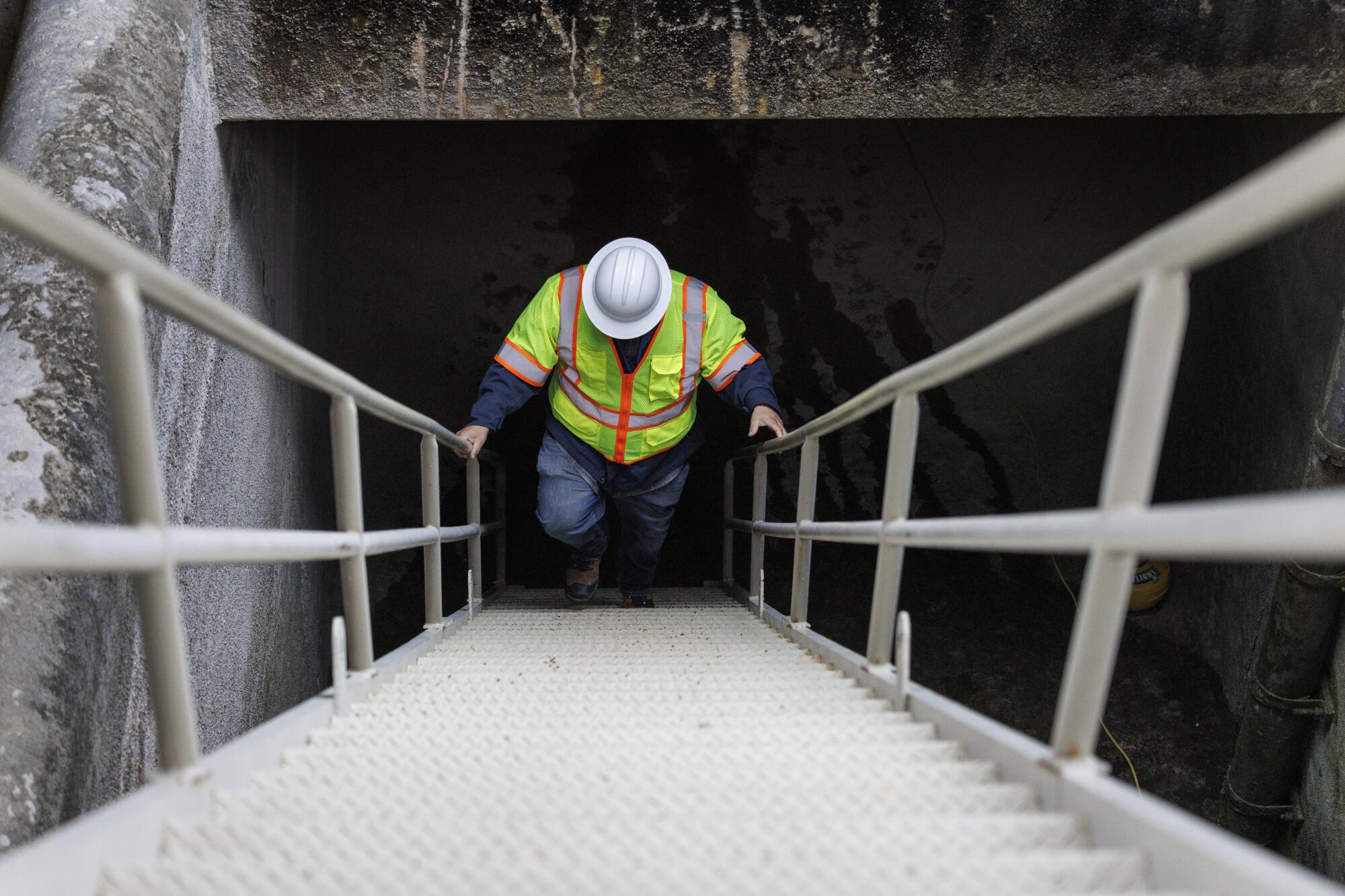
A steep steel staircase gives access to a water tunnel near the end point of the larger San Jacinto Tunnel, which carries Colorado River water to Southern California.


